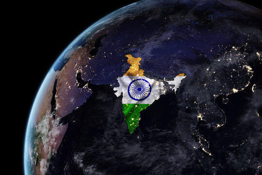

The map of India is a graphical depiction of the country's physical characteristics, borders, and significant sites. India, formally recognized as the Republic of India, is an expansive South Asian nation. As seen on the India Map, India's geographical area spans around 3.29 million square kilometers, making it the seventh-largest country in the world in terms of land area.
India is adjacent to several nations. It has a border with Pakistan to the northwest and is situated to the north of China and Nepal. Bhutan is located in the northeastern region, whereas India has borders with Bangladesh and Myanmar to the east. The southern region of the nation is bordered by the Indian Ocean, with the Arabian Sea to the west and the Bay of Bengal to the east.
The India Map can be characterized as triangular, with its southern portion reaching into the Indian Ocean. The northern section increasingly tapers as it approaches the border with Nepal. India's geographical geography is characterized by its vast and varied terrains. The Himalayan mountain range extends along the northern border, serving as a natural barrier.
The India Map illustrates the states and union territories of the country, which serve as administrative divisions. India is comprised of 28 states and 8 union territories. The country's cultural and linguistic variety is enhanced by the presence of capital cities and regional administrations in each state.


Amazing Facts About India
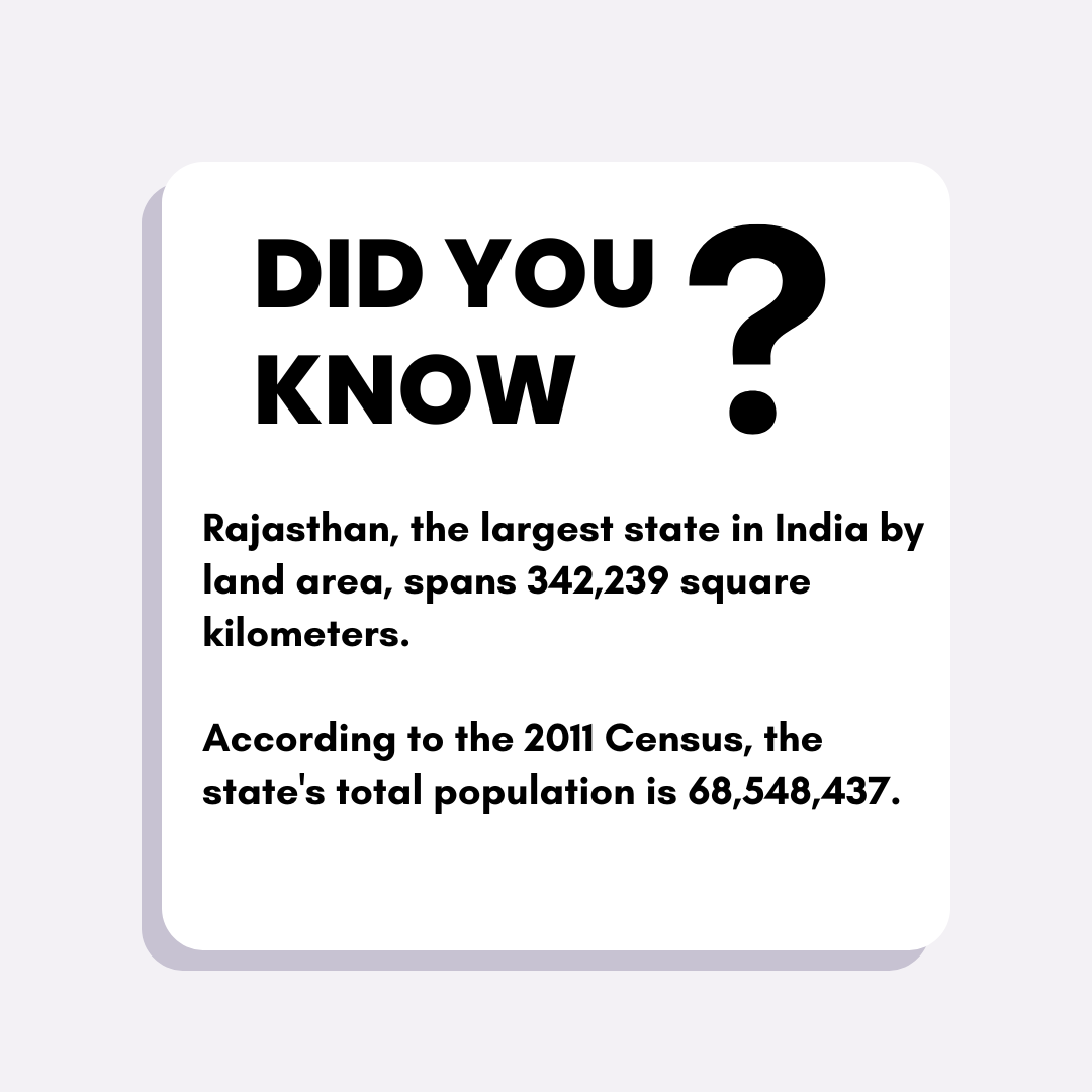
From the vast arid landscapes of Rajasthan and the tranquil coastlines of Goa to the vibrant tea estates of Kerala and the busy urban hubs of Mumbai and Kolkata, the many landscapes, religions, and civilizations make India incredibly captivating and exciting to the senses.
Discover interesting facts about India, ranging from its official language to the worldwide recognition of Bollywood as a leading film industry.
How many States are there in india?
20 Unique Facts About India
- India's population is 1.3 billion, specifically 1,350,438,098 individuals.
- India is projected to surpass the Chinese population by the year 2028.
- India ranks as the 7th largest country in terms of land area and holds the distinction of being the largest democracy in the world.
- India boasts a repertoire of more than 20 officially recognized languages.
- India derives its name from the Indus River.
- India is ranked 3rd globally in terms of record applications by the Guinness Book of World Records.
- India is the sole nation that has enacted legislation specifically protecting the rights of cows.
- India boasts the largest vegetarian population in the world.
- India possesses the most extensive postal network globally.
- India is home to the largest film industry in the world.
- India possesses the third most substantial military force globally, ranking below only the United States and China.
- India has the greatest congregation of people during the Kumbh Mela, which is so massive that it can be seen from space.
- Mawsynram holds the record for the highest average precipitation on a global scale.
- India boasts a staggering 125,226,449 individuals who are proficient in the English language, solidifying its position as the second-largest English-speaking country in the world.
- India has a staggering 300,000 operational mosques, a number that exceeds the total number of mosques found in Islamic countries.
- Decimals and zero originated in India and we are indebted to them for their contributions.
- The inaugural Indian rocket was conveyed using a bicycle.
- The invention of shampoo is attributed to the Indians.
- Switzerland commemorates A.P.J. Abdul Kalam on Science Day, which falls on May 26.
- Chess was invented in India before 600 AD.
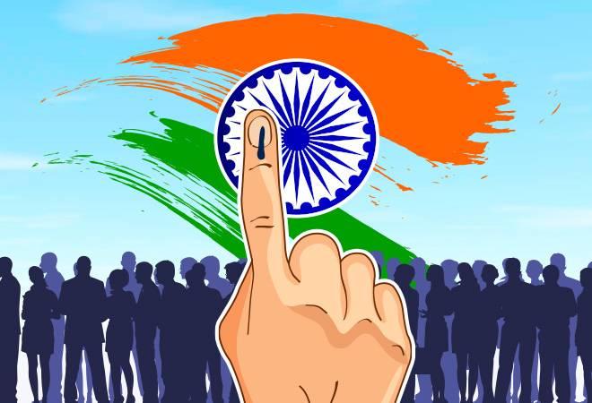
India's Political Map 2024
The Lok Sabha elections in India were conducted in seven parts, spanning from 19 April to 1 June 2024, to elect all 543 members of the Lok Sabha. The 18th Lok Sabha was established on 4 June following the tabulation of votes and the disclosure of the outcome.
| Region | Seats | NDA | I.N.D.I.A. | Others |
| North India | 151 | 83 | 72 | 6 |
| West India | 78 | 45 | 31 | 2 |
| Central India | 40 | 39 | 1 | 0 |
| East India | 118 | 72 | 45 | 1 |
| Northeast India | 25 | 16 | 7 | 2 |
| South India | 131 | 49 | 77 | 5 |
| Total | 543 | 293 | 234 | 16 |
BJP (NDA)-ruled States (with Current CMs)
| State | Chief Minister | Party |
| Andhra Pradesh | N. Chandrababu Naidu | TDP |
| Arunachal Pradesh | Pema Khandu | BJP |
| Assam | Himanta Biswa Sarma | BJP |
| Bihar | Nitish Kumar | JD(U) |
| Chhattisgarh | Vishnu Deo Sai | BJP |
| Goa | Pramod Sawant | BJP |
| Gujarat | Bhupendrabhai Patel | BJP |
| Haryana | Nayab Singh Saini | BJP |
| Madhya Pradesh | Mohan Yadav | BJP |
| Maharashtra | Eknath Shinde | Shiv Sena |
| Manipur | N. Biren Singh | BJP |
| Meghalaya | Conrad Sangma | NPP |
| Nagaland | Neiphiu Rio | NDPP |
| Odisha | Mohan Charan Majhi | BJP |
| Rajasthan | Bhajan Lal Sharma | BJP |
| Sikkim | Prem Singh Tamang | SKM |
| Tripura | Manik Saha | BJP |
| Uttar Pradesh | Yogi Adityanath | BJP |
| Uttarakhand | Pushkar Singh Dhami | BJP |
Congress (I.N.D.I.A.)-ruled States (with Current CMs)
| State | Chief Minister | Party |
| Himachal Pradesh | Sukhvinder Singh Sukhu | INC |
| Jharkhand | Champai Soren | JMM |
| Karnataka | Siddaramaiah | INC |
| Kerala | Pinarayi Vijayan | CPI(M) |
| Punjab | Bhagwant Mann | AAP |
| Tamil Nadu | M. K. Stalin | DMK |
| Telangana | Revanth Reddy | INC |
| West Bengal | Mamata Banerjee | AITC |
The Indian Peninsular Plateau
The Peninsular Plateau of India, alternatively referred to as the Deccan Plateau, is a flat elevated landmass situated in the southern part of India, surrounded by the oceans on three of its sides. It is a constituent of the five physiographic divisions of India. Not only is it the oldest continent on Earth, but it is also the largest physiographic divide globally. The Deccan Plateau holds great historical and geographical importance. Due to its central location, this city has served as a significant center for culture and trade throughout history, greatly influencing the subcontinent.
Characteristics of the Peninsular Plateau of India
| Shape: The Deccan Plateau, which is nearly rectangular, is located along the southern edge of the Indo-Gangetic Plains. From this point, it steadily descends till it reaches Kanyakumari. |
| Area & Extent: The Deccan Plateau, which is nearly rectangular, is located along the southern edge of the Indo-Gangetic Plains. From this point, it steadily descends till it reaches Kanyakumari. |
| Boundaries: The area is surrounded by mountain ranges on three sides. The northern boundary is defined by the Aravali Range, the Vindhya, the Satpura, the Bharmer, and the Rajmahal Hills. The Western Ghats function as the western demarcation. On the eastern side, it is bounded by the Eastern Ghats. |
| Composition: This ancient tabular block consists of schists and has an Archaean provenance. The barrier is regarded as sturdy and has had little structural alterations since its creation. |
| Drainage: The Peninsular Plateau has a mostly west-to-east inclination. The fundamental reason for the west-east direction of the major peninsular rivers (except Narmada and Tapi) is their discharge into the Bay of Bengal. |
| Elevation: The average elevation of the Peninsular Plateau in India is 600–900 meters above sea level. |
Significance of the Deccan Plateau
The Peninsular Plateau of India holds significant significance due to its status as the oldest and most geologically stable area in the Indian subcontinent.
The plateau is rich in mineral resources, including iron, copper, manganese, bauxite, chromium, mica, gold, and other valuable minerals.
The region has 98 percent of the nation's Gondwana coal reserves.
The region is distinguished by the existence of highly rich black soil, which is ideal for farming a diverse range of crops like cotton, tea, coffee, rubber, millet, and others.
Forest produce: These areas are abundant in forests and act as a bountiful source of timber and other forest resources.
The rivers in these locations possess favorable conditions for the creation of hydroelectric power and also provide irrigation for agricultural purposes.
Tourism: The area offers several scenic sites, such as Ooty, Pachmarhi, Kodaikanal, Mahabaleshwar, Mount Abu, and others.
Rivers of India
The Indian population is greatly influenced by its rivers. The nation's river systems offer energy, affordable transportation, agriculture, and drinking water, and support many livelihoods. This explains why most major Indian cities have riverbank settings. The Indus, Brahmaputra, Narmada, Tapi, Godavari, Krishna, Kaveri, and Mahanadi are the main rivers of India.
Indus
Ancient Hindu scriptures and legends mention the Indus (Sindhu) River. The 'Puranik River' is its common name. The river starts near Mansarovar Lake in Tibet. It flows west through Jammu and Kashmir, Himachal Pradesh, Punjab, and Pakistan. It joins the Arabian Sea at Karachi after heading west. The Indus River is Pakistan's largest and national river. This river's tributaries in India include Zanskar, Nubra, and Shyok, and in Pakistan, Hunza. Punjab is named for the Sutlej, Ravi, Beas, Chenab, and Jhelum rivers.
The Indus River is a significant trans-Himalayan river in South Asia, known for being one of the longest rivers globally, stretching approximately 2,000 miles (3,200 km).
Ganga
India's largest river system is the Ganga. It comes from the Gangotri glaciers. The Ganga River forms near Devprayag where the Bhagirathi and Alaknanda rivers meet. Ganga has streams on both sides, including the Yamuna and Son on the right. Ghaghara, Gandak, Kosi, and Gomti are left-bank tributaries. The Ganges flows through Uttarakhand, Uttar Pradesh, Madhya Pradesh, Himachal Pradesh, Bihar, and West Bengal. It reaches the Bay of Bengal.
Yamuna
A major river network in Northern India is the Yamuna. From Yamnotri, the river flows through Uttrakhand, Uttar Pradesh, and Haryana. After passing through Delhi, Mathura, and Agra, the river joins the Ganga in Allahabad after combining with the Chambal, Betwa, and Ken. Tons, Chambal, Hindon, Betwa, and Ken Rivers are major Yamuna tributaries.
Brahmaputra
Angsi glacier in Tibet feeds the Brahmaputra, a major Indian river. It's called the Tsangpo River there. The Dihang River enters India from Arunachal Pradesh. The Dibang, Lohit, and Kenula rivers join to form the Brahmaputra. The river travels through Assam, Bangladesh, and the Bay of Bengal. In India, the Brahmaputra River has the most water.
The Brahmaputra River begins in the northern Kailash ranges of the Himalayas at a height of 5,150 m just south of a lake named Konggyu Tsho, and it stretches for a total distance of 2,900 km. In India, it covers a distance of 916 km. It is the 9th longest river in the world.
The name "Brahmaputra" is derived from the Sanskrit word "brahmaputra" which means "son of Brahma", with "brahma" referring to the Hindu god Brahma and "putra" meaning "son".
Mahanadi
The Mahanadi is a major East-central Indian river. The river originates in Chhattisgarh's Sihava mountains and flows into Orissa. This river deposits the most silt in India. The Mahanadi flows through Sambalpur, Cuttack, and Banki.
Godavari
The Ganga River is India's longest, while the Godavari is second. The river starts in Triambakeshwar, Maharashtra, and flows through Chhattisgarh, Madhya Pradesh, Odisha, Telangana, Andhra Pradesh, Karnataka, and Puducherry to the Bay of Bengal. Branches including Pravara, Indravati, and Maner Sabri support its flow. Due to its length, the river is called Dakshina Ganga.
Krishna
The Krishna River, at 1,300 kilometers, is India's third longest. Starting in Mahabaleshwar, Maharashtra, this river flows through Karnataka, Telangana, and Andhra Pradesh before emptying into the Bay of Bengal. Ghataprabha, Malaprabha, Bhima, and Tungabhadra are Krishna's main affluents.
Kaveri
The Cauvery (Kaveri) originates as a spring on Brahmagiri Hill near Tala Kaveri in Kogadu, Karnataka. Known as the Ganges of the South, this river is sacred in South India. The Kaveri River widens as Hemavati, Moyari, Shimsha, Arkavati, Honnuhole, Kabini, Bhavani, Noyill, and Amaravati tributaries join it. The river flows into the Bay of Bengal after 805 kilometers via Karnataka, Kerala, and Tamil Nadu, briefly touching Pudducherry.
Tapi and Narmada
Narmada and Tapti are the only major rivers that discharge into the Arabian Sea. The 1,312-kilometer Narmada River flows through Madhya Pradesh, Maharashtra, and Gujarat. Amarkantak, in Shahdol, Madhya Pradesh, is the Narmada River source. The Narmada River flows east-west across Central India into the Arabian Sea.
Before reaching the Gulf of Khambhat, the Tapti River travels parallel to the Narmada River in Maharashtra and Gujarat. This river's main tributaries are Purna, Girna, and Panjhra.
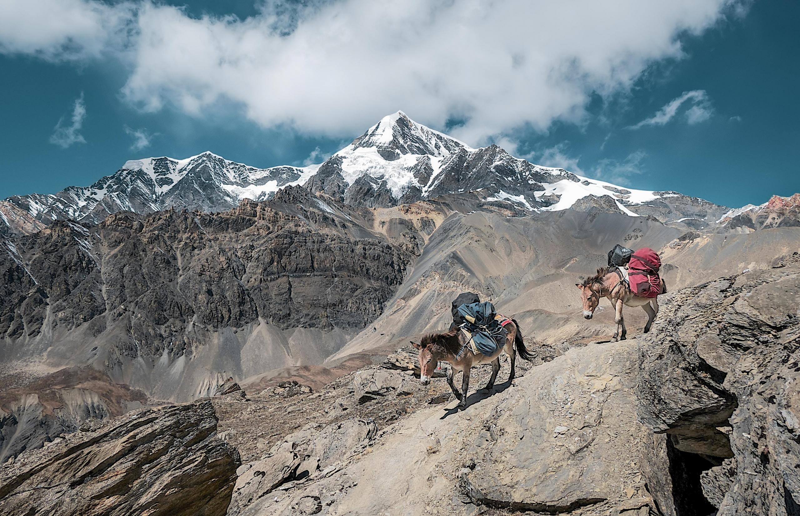
Mountains of India
Seven Mountain Ranges in India have summits over 1,000 meters. The highest and most famous mountain range in India is the Himalayas.
The Himalayas
The world's tallest, latest, and highest mountains are the Himalayas. Over 100 of the world's highest peaks are in the Himalayas, with an average elevation of 7200 meters. Mt. Everest, at 8848 meters, is the highest point on Earth. This site is in Nepal. The Mountains gave rise to the Ganges, Brahmaputra, and Indus.
Karakoram
The westernmost range, the Karakoram, crosses the Line of Control with China. K2, the second-highest mountain in the world, is in the Karakoram Range at 8,611 meters. Afghan Hindu-Kush Range extends into the Karakoram Range. The Karakoram has the most ice sheets outside the Polar Regions. Biaflo and Siachen glaciers, the world's second and third biggest, are in Tibet.
Purvanchal Range
The massive mountain range spans 94,800 km2. This is India's eastern border. The Eastern Mountainous Region, or Mizo Hill, includes Patkai-Bum Mountain, Lushai Hill, and Garo-Khasi-Jaintia Hill in Purvanchal. Meghalaya's Mawsynram has the highest precipitation on Earth. It's in Khasi Hills. The region includes all the northeastern states, known as the Seven Sisters.
Vrindhya and Satpura
Northern India has the Satpura and Vindhya mountains. The longest range, the Satpura, is the source of the Narmada and Brahmaputra. Satpura and Vindhya mountain ranges are mostly in Madhya Pradesh and Maharashtra, with some in Gujarat, Chattisgarh, and Uttar Pradesh.
Aravallis
One of India's oldest peak summits, the ranges cover 800 km. The Aravallis traverse the states of Rajasthan, Delhi, Haryana, and Gujarat. The Aravalli Mountains also include India's only desert. It inhibits rain-carrying winds from reaching the Thar Sands.
Western Ghats
The Western Ghats run 1500km from Gujarat to Kanyakumari, Tamil Nadu. This UNESCO World Heritage Site is known for its variety. The 2695-meter Anaimalai Hills in Kerala are the highest peaks in this group.
Eastern Ghats
The Eastern Indian Peninsula is surrounded by high mountains. The Eastern Ghats drain four important Indian rivers—the Mahanadi, Krishna, Godavari, and Kaveri—which run into the Bay of Bengal, making them vital to Indian agriculture. A vast, fertile region is ideal for rice development.
10 Highest Mountain Peaks in India
- Kangchenjunga (Sikkim): 8586 m
- Nanda Devi (Uttarakhand): 7816 m
- Kamet (Uttarakhand): 7756 m
- Saltoro Kangri (Jammu & Kashmir): 7742 m
- Saser Kangri (Jammu & Kashmir): 7672 m
- Momostong Kangri (Jammu & Kashmir): 7516 m
- Rimo (Jammu & Kashmir): 7385 m
- Hardeol (Uttarakhand): 7151 m
- Chaukamba (Uttarakhand): 7138 m
- Trisul (Uttarakhand): 7120 m
India is a beautiful country, there's everything in this country from linguistic diversity to high mountains, have you thought about traveling to India in 2024?
Summarise with AI:
Enjoyed this article? Leave a rating!